JOHN MAURER
Pacific Islands Ocean Observing System (PacIOOS) • University of Hawaiʻi at Mānoa
• https://johnolulu.github.io
1680 East-West Rd, POST-602, Honolulu, HI, USA (on the island of Oʻahu)
PROFESSIONAL EXPERIENCE

- Pacific Islands Ocean Observing System (PacIOOS), University of Hawaiʻi at Mānoa, Honolulu, HI, USA. July 16, 2009 - present:
- National Snow and Ice Data Center (NSIDC),
University of Colorado, Boulder, CO, USA. March 1, 2001 - June 1, 2009:
- Web/Database Applications Engineer, September 13, 2004 - June 1, 2009.
- User Services Representative, July 1, 2003 - September 10, 2004.
- Operations Technician II, May 1, 2002 - June 30, 2003.
- Operations Technician I, March 1, 2001 - April 30, 2002.
EDUCATION


- University of Hawaiʻi at Mānoa: Master's in Computer Science, In progress: 2025 to present. Artificial Intelligence and Data Science Track, Information and Computer Sciences (ICS).
- University of Colorado at Boulder: M.A. in Geography, May 2006. Advisor: Dr. Konrad Steffen. Thesis topic: Local-scale snow accumulation variability on the Greenland ice sheet from ground-penetrating radar (GPR) (click here for details).
- University of Colorado at Boulder: Graduate Certificate in Remote Sensing, Program in Atmospheric and Oceanic Sciences (PAOS), Fall 2001 - May 2003.
- Stanford University, Palo Alto, CA: B.A. Music, with distinction, June 1999. Specialization in "Music, Science and Technology" (MST) through the Center for Computer Research in Music and Acoustics (CCRMA): coursework in computer technology (programming; synthesis & analysis of sound; music software), recording technology, digital signal processing, and physics/acoustics (click here for details).
- Hopkins Marine Station (HMS), Stanford University, Monterey, CA. Winter 1998. Marine science and underwater acoustics (click here for details).
RELEVANT COURSEWORK
- Artificial Intelligence: Applied Computing Industry Seminar, Applied AI
- Remote Sensing: Remote Sensing of Environment, Remote Sensing Image Analysis, Remote Sensing Field Methods, Remote Sensing Graduate Seminar, Remote Sensing of the Atmosphere and Oceans.
- Geography: Climate Modeling, Readings in Climatology, History and Theory of Geography, Research Design in Physical Geography, Generic Mapping Tools (GMT), Earth System Science Databases.
- Computer Science: Introduction to IDL, Programming Methodology, Programming Abstractions, Programming Paradigms, Introduction to Unix, Programming Perl, Web Database Applications, Advanced JavaScript, Software Construction Workshop, Perl Best Practices, Unidata Workshop (NetCDF and THREDDS), Deep Learning
- Physics: Mechanics, Electricity, Magnetism.
- Calculus: Calculus I, Calculus II.
- Statistics: Graduate Statistics.
- Music, Science and Technology: Computer Sound, Computer Algorithms, Research in Computer Music, Theory and Practice of Audio Recording, Psychoacoustics.
ONLINE CERTIFICATES
- Ocean Data Management 2025. Ocean Teacher Global Academy (OTGA), UNESCO Intergovernmental Oceanographic Commission (IOC). April, 2025.
- Google AI Essentials. Coursera. February, 2025.
COMPUTER SKILLS
- AI/ML: PyTorch, YOLO, Codex, Gemini Gem
- Geospatial: Python, GeoServer, Leaflet, GDAL/OGR, PostGIS, QGIS, Google Maps API, Google Earth, KML, GeoJSON, OGC Services (WMS, WFS, WCS, CSW), THREDDS Data Server (TDS), NetCDF, OPeNDAP, ERDDAP, Dygraphs, Flot, metadata standards (ISO 19115, FGDC, NetCDF CF, GCMD Keywords), ENVI, IDL.
- Languages: Python, Perl, IDL, SQL, HTML, CSS, JavaScript, JSON, XML, XML Schema, XSLT; once upon a time: SAS/STAT, C, C++, Lisp.
- Software: WordPress, Word, Excel, PowerPoint, Photoshop.
HONORS AND AWARDS
- RCUH 2016 Outstanding Employee of the Year nominee, Research Corporation of the University of Hawaiʻi (RCUH), 2016. 1 of 25 final nominees out of ~2,800 RCUH employees statewide.
- Best Poster Paper Award, International Polar Year (IPY) GeoNorth 2007: First International Circumpolar Conference on Geospatial Sciences and Applications, Yellowknife, Northwest Territories, Canada, 2007. Click here to view poster; click here to view paper.
- CIRES 2007 Outstanding Performance Award, Cooperative Institute for Research in Environmental Sciences (CIRES), University of Colorado at Boulder, 2007. 1 of 2 selected annually for the Service Award out of ~500 employees.
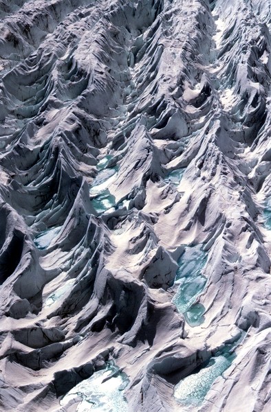
- CU Art in Science | Science in Art juried exhibition, University of Colorado, 2007. 1 of 30 images selected for a traveling museum exhibit. Click here to view image.
- Robert M. Golden Medal for Excellence in Humanities and Creative Arts, Stanford University, 1999. Awarded to top 10% of Stanford undergraduate honors projects in the creative arts.
- Stanford Undergraduate Research Opportunities Major Grant recipient ($2000), for Computer-Automated Music Composition Honors project, 1998-1999.
- Stanford Undergraduate Research Opportunities Small Grant recipient ($500), for Underwater Acoustics research at Hopkins Marine Station, Monterey, CA, Winter 1998.
- Deans' Award for Academic Accomplishment, Stanford University, 1997. 1 of 11 selected out of 6500 undergraduates.
PUBLICATIONS
- Potemra, J., J. Maurer, and E.S. Burns (2016), Providing Oceanographic Data and Information to Pacific Island Communities. In P. Diviacco, A. Leadbetter, and H. Glaves (Eds.). Oceanographic and Marine Cross-Domain Data Management for Sustainable Development. 425 pp. Hershey, PA: IGI Global.
- Maurer, J. (2007), A Summer on Ice: Research on the Greenland Ice Sheet. In B.W. Pipkin, D.D. Trent, R. Hazlett, and P. Bierman. Geology and the Environment. 5th ed. (2 pp.) Belmont, CA: Brooks/Cole.
- Maurer, IV,, J.A. (2006), Local-scale snow accumulation variability on the Greenland ice sheet from ground-penetrating radar (GPR). Master’s thesis, University of Colorado at Boulder. Available from https://johnolulu.github.io/gpr/.
- Maurer, J. (2004), An Introduction to the EOSDIS Core System (ECS) at NSIDC. NSIDC Special Report 12. Boulder, CO, USA: National Snow and Ice Data Center. Digital media. http://nsidc.org/pubs/special/12/index.html
PRESENTATIONS
Talks:
- Maurer, J., M. Walton, and K. Hintzen (2022), King Tides Project: Mobile GIS for Collecting and Mapping Photos. Hawaii Geographic Information Coordinating Council (HIGICC) Honolulu Geospatial Expo 2022. August 5, 2022, Honolulu, HI, USA. [Click here to view (24 MB).]
- Maurer, J. (2019), Open Source GIS and other Geospatial Data from the Pacific Islands Ocean Observing System (PacIOOS). Discovering the World Through GIS: GIS Day Lightning Talks by UHM GIS Faculty and Professionals. November 13, 2019. Honolulu, HI, USA. [Click here to view (6.6 MB).]
- Maurer, J. (2019), Ocean Observations: Data Storage and Transfer. Fourth Data Buoy Cooperation Panel (DBCP) Pacific Islands Training Workshop on Ocean Observations and Data Applications (DBCP-PI-4). September 14, 2019. Honolulu, HI, USA. [Click here to view (7.2 MB).]
- Maurer, J. and F. Langenberger (2019), Data Streams at PacIOOS: From Acquisition to End Products. Hawaii Surveying And Mapping Conference 2019. March 21, 2019, Honolulu, HI, USA. [Click here to view (7.4 MB).]
- Maurer, J. and F. Langenberger (2018), PacIOOS Projects Using Open Source GIS for Web Visualization. Hawaii Geographic Information Coordinating Council (HIGICC) Oahu Geospatial Expo 2018. June 22, 2018, Honolulu, HI, USA. [Click here to view (4.9 MB).]
- Maurer, J. and R. Coughlin (2012), PacIOOS GIS Workshop: Open Source Applications in Web Mapping. Hawaii Pacific GIS Conference. March 8, 2012, Honolulu, HI, USA. [Click here to view Google Maps API presentation (132 KB).]
- Potemra, J. T., J. Maurer, R. Coughlin, R. Buzzetti and S. DeCarlo (2010), Data services for Pacific Island communities: Developing the Pac ific Integrated Ocean Observing System. IMDIS-2010 Proceedings, IFREMER/SISMER, M. Fichaut and V. Tosello, Editors, 224 pp.
- Maurer, J. and K. Steffen (2007), Local-scale snow accumulation variability on the Greenland ice sheet from ground-penetrating radar (GPR). Presentation #NS14A-06. American Geophysical Union (AGU) Fall Meeting. December 10-14, 2007, San Francisco, CA, USA. [Click here to view abstract; click here to view presentation (5.1 MB).]
- Maurer, J., K. Steffen, and R. Huff (2006), Local-scale snow accumulation variability on the Greenland ice sheet from ground-penetrating radar (GPR). 36th International Arctic Workshop. March 16-18, 2006, Boulder, CO, USA.
Posters:
- Abecassis, M., E.A. Howell, and J. Maurer (2018), OceanWatch: A Multi-Pronged Approach to Disseminating Ocean Remote Sensing Data. Poster #IN53C-0624. American Geophysical Union (AGU) Fall Meeting. December 10-14, 2018, Washington, D.C., USA. [Click here to view abstract; click here to view poster (3.2 MB).]
- Maurer, J., C. G. Meyer, and E. Burns (2014), Near Real-Time Tiger Shark Monitoring Around Maui. Abstract #13386, Poster #2088. Ocean Sciences Meeting. February 23-28, 2014, Honolulu, HI, USA. [Click here to view (4.7 MB).]
- Iwamoto, M., J. Maurer, and D. Brown (2014), Using Real-Time Data in the Classroom with the Pacific Islands Ocean Observing System (PacIOOS) Voyager. Abstract #14030, Poster #1729. Ocean Sciences Meeting. February 23-28, 2014, Honolulu, HI, USA. [Click here to view (5.2 MB).]
- Maurer, J., J. T. Potemra, and R. Coughlin (2012), Data Services for IOOS Regional Association for the Pacific, PacIOOS. Poster #IN41A-1472. American Geophysical Union (AGU) Fall Meeting. December 3-7, 2012, San Francisco, CA, USA. [Click here to view (4.46 MB).]
- Maurer, J., J. Bohlander, T. Haran, T. Scambos, and R. Bauer (2008), Geo-spatial browse and distribution of NSF-OPP's Antarctic ice and climate data via the Web: Antarctic Cryosphere Access Portal (A-CAP). Poster #IN33A-1163. American Geophysical Union (AGU) Fall Meeting. December 15-19, 2008, San Francisco, CA, USA. [Click here to view (381 KB).]
- Maurer, J. (2007), Atlas of the Cryosphere: Mapping the Earth's Frozen Regions on the Internet. Poster/Paper. IPY GeoNorth 2007. August 20-24, 2007, Yellowknife, NWT, Canada. [Click here to view poster (0.7 MB); click here to view paper (0.3 MB).]
- Maurer, J. (2007), Atlas of the Cryosphere: A Web Map Service for the Earth's Frozen Regions. Poster #3-5. Geoinformatics. May 17-18, 2007, San Diego, CA, USA. [Click here to view (0.7 MB).]
- Maurer, J. and E. M. Sheffield (2006), Atlas of the Cryosphere: A Dynamic Web Mapping Tool for Exploring the Cryosphere. Poster #ED23B-1241. American Geophysical Union (AGU) Fall Meeting. December 11-15, 2006, San Francisco, CA, USA. [Click here to view (0.7 MB).]
- Maurer, J., R. Swick, and V. J. Troisi (2006), Dynamic Access to Cryospheric Data at the National Snow and Ice Data Center (NSIDC). Poster #IN43C-0913. American Geophysical Union (AGU) Fall Meeting. December 11-15, 2006, San Francisco, CA, USA. [Click here to view (0.6 MB).]
- Maurer, J., M. Marquis, and M. Savoie (2004), Tools for working with the Geoscience Laser Altimeter System (GLAS) Data Products from the Ice, Cloud, and land Elevation Satellite (ICESat) Mission. Poster #C33B-0354. American Geophysical Union (AGU) Fall Meeting. December 13-17, 2004, San Francisco, CA, USA. [Click here to view (0.3 MB).]
- Maurer, J., M. Marquis, and M. Savoie (2004), Tools for working with the Geoscience Laser Altimeter System (GLAS) Data Products from the Ice, Cloud, and land Elevation Satellite (ICESat) Mission. Poster. Workshop on NASA Earth Observing System (EOS) Snow and Ice Products. November 16-17, 2004, Landover, MD, USA. [Click here to view (0.3 MB).]
- Maurer, J., S. J. S. Khalsa, M. Marquis, and M. Smith (2003), Advanced Microwave Scanning Radiometer - Earth Observing System (AMSR-E) product overview. Poster #H32B-0550. American Geophysical Union (AGU) Fall Meeting. December 8-12, 2003, San Francisco, CA, USA. [Click here to view (0.9 MB).]
- Schumacher, H. V., S. S. Khalsa, M. C. Marquis, J. A. Maurer, and M. H. Savoie (2003), Data Products from the Ice, Cloud, and Land Elevation Satellite (ICESat) Geoscience Laser Altimeter System (GLAS) at the National Snow and Ice Data Center (NSIDC) Distributed Active Archive Center (DAAC). Poster #C32A-0423. American Geophysical Union (AGU) Fall Meeting. December 8-12, 2003, San Francisco, CA, USA. [Click here to view (1.6 MB).]
SOFTWARE/TOOLS DEVELOPMENT
- PacIOOS Website: Data Visualization. Dynamic online data visualization of both raster maps and time series plots of PacIOOS forecast models and point-based observations; e.g., http://pacioos.org/waves/model-maui/ (wave forecast) and http://pacioos.org/waves/buoy-waimea/ (wave buoy), etc.
- PacIOOS Voyager. A Google Maps API for dynamically viewing and downloading maps and data related to Hawaiʻi and other U.S.-affiliated Pacific Islands as part of the Pacific Islands Ocean Observing System (PacIOOS). http://pacioos.org/voyager/
- PacIOOS Voyager Mobile. A mobile-friendly version of my PacIOOS Voyager mapping site. http://pacioos.org/voyager/mobile/
- Hawaiʻi Tiger Shark Tracking. Animates the movements of several tiger sharks in near real-time who are fitted with satellite tags. http://pacioos.org/projects/sharks/
- Hawaiʻi Sea Level Rise Viewer. Maps future sea level rise exposure areas around the State of Hawaiʻi using GeoServer and the Leaflet mapping API. http://pacioos.org/shoreline/slr-hawaii/
- American Samoa Sea Level Rise Viewer. Maps future sea level rise extent and depth across American Samoa using GeoServer and the Leaflet mapping API. http://pacioos.org/shoreline/slr-amsam/
- Hawaiʻi and Pacific Islands King Tides Project. Ingests, archives, maps, and displays "community science" photo submissions documenting coastal inundation and flooding due to astronomical "king tide" events. System includes mobile-friendly photo submission utility (http://pacioos.org/king-tides/), mapping and display platform (http://pacioos.org/king-tides/map.html), and authenticated admin interface for management by staff members.
- Honolulu Sea Level Rise Inundation Risk. Depicts current and future inundation from one meter of sea level rise with or without the impacts of tsunami and hurricanes using GeoServer and the Leaflet mapping API. http://pacioos.org/shoreline/slr-honolulu/
- West Maui Wave-Driven Flooding With Sea Level Rise Maps predictions of future sea level rise with wave impacts for the coastline of West Maui using THREDDS and the Leaflet mapping API. http://pacioos.org/shoreline/slr-westmaui/
- East Babeldaob, Palau Wave-Driven Flooding With Sea Level Rise. Maps predictions of future sea level rise with wave impacts for the coastline of East Babeldaob using THREDDS and the Leaflet mapping API. http://pacioos .org/shoreline/slr-eastpalau/
- Estimated Coral Cover in Hawaiʻi. A Leaflet-based online mapping platform for dynamically viewing and querying maps of estimated coral cover around the main Hawaiian islands using data produced by Erik Franklin et al. http://pacioos.org/projects/coral/
- Hawaiian Koʻa (Coral) Card: Coral Health Assessments. Ingests, archives, maps, and displays "citizen science" coral observations documenting the color, shape, species, and other data attributes for purposes of monitoring coral bleaching events. System includes mobile-friendly data submission utility (http://pacioos.org/coral-card/), mapping and display platform (http://pacioos.org/coral-card/map.html), and authenticated admin interface for management by staff members.
- Ocean Tipping Points: Hawaiʻi Case Study. A Leaflet-based online mapping platform for dynamically viewing and querying maps of environmental and anthropogenic drivers of coral reef ecosystems around the main Hawaiian islands using data produced by the multi-institutional Ocean Tipping Points (OTP) project team. http://pacioos.org/projects/otp/
- PacIOOS Data Search. A user-friendly search interface for finding geospatial datasets at PacIOOS, powered by pycsw and PostGIS to utilize OGC Catalog Service for the Web (CSW) search standards. http://pacioos.org/data/search/
- PacIOOS Metadata. Web-accessible folders (WAF) for FGDC and ISO 19115 XML geospatial metadata records including XSLT stylesheets for dynamic HTML presentation. http://pacioos.org/data/metadata/
- Atlas of the Cryosphere. A dynamic web map server for viewing information from global to local scales related to snow, sea ice, glaciers, ice sheets, permafrost, and more. http://nsidc.org/data/atlas/ (defunct)
- GPR IDL Tools. IDL and ENVI software tools for opening, viewing, filtering, and analyzing Malå Geoscience RAMAC™ ground-penetrating radar (GPR) data. http://gpr-idl-tools.sourceforge.net
- Trak. A web/database interface for tracking and searching user support requests at the National Snow and Ice Data Center (NSIDC). Also includes a rolodex of user contact information and a utility for generating custom mailing lists.
PROFESSIONAL SERVICE
- Technical reviewer for:
- Baghat, Karim (2015), Python Geospatial Development Essentials. Packt Publishing. 192 pp.
- Lawhead, Joel (2015), Learning Geospatial Analysis with Python. Packt Publishing. 367 pp.
Last Updated: June 12, 2026
John Maurer <>